Position: Home > > Measurement instrument > Length measuring instrument > Other Length area measuring instrument > ELS Series High Precision Digital Level

ELS Series High Precision Digital Level

Product ID:CLCDqtOther033

Price: Please inquire PDF Format
Supply Ability:50 SETS/MON
Port:SHENZHEN
  • Product Introduction
  • Other information
  • Model NumberELS Series
    Brand NameSZYIGUANG
    Payment TermsTT,PAYPAL,Alibaba.com Pay
    ELS Series High Precision Digital Level
    Product Introduction
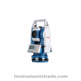
    ELS Series High Precision Digital Level is an advanced electronic surveying instrument designed for high-precision elevation measurement, engineering surveying, and deformation monitoring. Combining a high-performance optical system, intelligent electronic control technology, automatic leveling functions, and digital measurement capabilities, the ELS Series provides millimeter-level accuracy for demanding applications such as highways, railways, hydraulic engineering, and structural settlement monitoring.
    With a newly optimized optical design featuring up to 43× magnification and 50mm effective aperture, the instrument delivers clear and stable images even under challenging conditions such as tunnels, forests, and low-light environments. The integrated electric leveling base, wide-angle camera, and electronic bubble system simplify field operation and significantly improve measurement efficiency.
    The ELS Series achieves 0.2mm/km leveling accuracy and supports a measurement range of up to 200m, providing reliable performance for professional surveying projects requiring high precision and long-distance observation.


    Key Features
    • Automatic Electric Leveling Base
    The integrated electric leveling base combines high-precision sensors with intelligent algorithms to achieve automatic instrument leveling with one-touch operation.
    Benefits include:
    • Eliminates complicated manual leveling procedures
    • Reduces operator workload and training requirements
    • Improves leveling efficiency in field environments
    • Provides stable and reliable instrument setup


    • Wide-Angle Camera for Fast Target Recognition
    The built-in wide-angle camera provides a broad field of view, helping operators quickly locate and lock onto leveling staffs.
    Advantages:
    • Quickly identifies staffs in complex environments
    • Reduces repeated instrument adjustment time
    • Improves measurement speed and workflow efficiency


    • Electronic Bubble System
    The electronic bubble replaces traditional visual bubble leveling with digital monitoring technology.
    Features:
    • Real-time instrument leveling status display
    • Reduced influence from lighting conditions and viewing angle
    • Improved leveling accuracy and operational reliability


    • High Precision Measurement Performance
    With a leveling accuracy of up to 0.2mm/km, the ELS Series provides reliable measurement results for precision engineering projects.
    Typical applications include:
    • Highway construction control networks
    • Railway engineering surveying
    • Large-scale hydraulic projects
    • Building settlement monitoring
    • Structural deformation analysis


    • Long Measurement Range up to 200m
    Through optical optimization, electronic control, and advanced algorithms, the ELS Series extends measurement capability up to 200 meters.
    Benefits:
    • Covers larger surveying areas
    • Reduces instrument repositioning frequency
    • Improves field productivity


    • High Performance Telescope System
    The optimized telescope system provides excellent observation performance.
    Main optical advantages:
    • Up to 43× magnification
    • 50mm effective aperture
    • Clear and sharp staff images
    • Excellent visibility in low-light environments


    Working Principle
    The ELS Series High Precision Digital Level uses electronic image recognition technology to automatically read coded leveling staffs and calculate elevation differences with high accuracy.
    The measurement process includes:
    The telescope captures the barcode staff image through the precision optical system.
    The electronic sensor analyzes the coded scale information.
    The internal processor calculates height differences and distance values.
    The automatic compensation system corrects instrument inclination errors.
    Measurement results are displayed and stored digitally.
    The combination of optical imaging, electronic recognition, and intelligent compensation technology enables fast, accurate, and repeatable surveying results.


    Technical Parameters
    Parameter ELS02 / ELS03 ELS05 / ELS07
    Leveling Accuracy (1km double run) 0.2mm (ELS02) / 0.3mm (ELS03) 0.5mm (ELS05) / 0.7mm (ELS07)
    Digital Reading Staff Invar barcode staff Fiberglass barcode staff
    Distance Measurement Accuracy D≤10m: <±10mm; D10m: ±0.1%×D mm Same
    Measurement Range 2–200m 2–180m
    Minimum Display Resolution (Height) 0.01mm / 0.0001ft selectable Same
    Minimum Display Resolution (Distance) 1mm / 0.01ft selectable Same
    Measurement Time 2s 2s
    Telescope Magnification 43× 38×
    Effective Aperture 50mm 45mm
    Minimum Focusing Distance 0.9m 1.0m
    Resolution 3″ 3.3″
    Compensator Range ±14′ ±14′
    Compensator Accuracy 0.2″ 0.2″
    Internal Storage 2GB + 16GB USB drive 2GB + optional USB
    Data Management Supported Supported
    Wide Angle Camera Standard Optional (ELS05), unavailable (ELS07)
    Camera Field of View 6°×5° 6°×5°
    Camera Frame Rate 20 fps 20 fps
    Electronic Bubble Standard Optional / unavailable
    Electronic Bubble Working Range 0.13° 0.13°
    Electronic Bubble Accuracy 0.015° 0.015°
    Electric Leveling Base Optional Optional / unavailable
    Leveling Range 3.5° 3.5°
    Voice Prompt Available Available
    Circular Bubble 8′/2mm 8′/2mm
    Display 3.5-inch color touchscreen, 320×480 resolution Same
    Keypad 25 keys 23 keys
    i Angle Inspection Program Available Available
    Communication Interface Type-C, Bluetooth, USB, RS-232 optional Same
    Protection Rating IP54 (including battery) IP54
    Operating Temperature -20℃ to +50℃ -20℃ to +50℃
    Storage Temperature -40℃ to +70℃ -40℃ to +70℃
    Battery 2600mAh / 7.2V lithium battery Same
    Operating Time More than 12 hours More than 12 hours
    Weight 4.1kg (battery included, ELS02 information provided) Not provided
     

    Application Areas
    • Highway and Railway Construction Surveying
    The high precision leveling capability ensures accurate elevation control during large-scale transportation infrastructure projects.
    • Hydraulic Engineering Projects
    Suitable for dam construction, water conservancy facilities, and large engineering deformation monitoring.
    • Building Settlement Monitoring
    Provides reliable elevation data for long-term structural settlement observation.
    • Geotechnical and Deformation Monitoring
    Used for monitoring ground movement, foundation deformation, and engineering stability.
    • Precision Engineering Surveying
    Ideal for professional surveying organizations requiring high accuracy and digital workflow efficiency.


    ELS Series vs Traditional Optical Level
    Comparison Item ELS Series Digital Level Traditional Optical Level
    Measurement Method Automatic electronic reading Manual optical reading
    Accuracy Up to 0.2mm/km Depends heavily on operator skill
    Staff Recognition Automatic barcode recognition
  • Frequently Asked Questions (FAQ)
    1. What is an ELS Series High Precision Digital Level used for?
    ELS Series Digital Level is mainly used for precision elevation measurement, engineering surveying, railway and highway construction, deformation monitoring, and settlement observation.
    2. What accuracy can the ELS Series achieve?
    The highest accuracy model, ELS02, provides 0.2mm/km leveling accuracy, making it suitable for high-precision control networks.
    3. What is the maximum measurement distance?
    The ELS02 and ELS03 models support measurement distances up to 200 meters, while ELS05 and ELS07 support up to 180 meters.
    4. Does the instrument support automatic leveling?
    Yes. Selected models support an electric leveling base that automatically adjusts the instrument using intelligent sensors and algorithms.
    5. Can it work in low-light environments?
    Yes. The high-performance telescope with large aperture provides clear staff images in tunnels, forests, and other low-light conditions.
    6. Which ELS model should I choose?
    ELS02/ELS03 are recommended for projects requiring the highest accuracy and advanced functions. ELS05/ELS07 are suitable for general engineering surveying with different budget requirements.
    7. What industries commonly use this digital level?
    It is widely used in:
    • Surveying and mapping companies
    • Highway and railway construction
    • Civil engineering projects
    • Water conservancy engineering
    • Infrastructure monitoring organizations


Products
Analytical instruments
Physical property test
Environmental monitoring and analysis
Lab general equipment
About us
About this website
Our service
Product purchase
Contact Us

Newsletter

Make Sure you dont miss interesting happenings by joining our newsletter program.

Contact Us
+86-18620722006
instruments@instrumentstrade.com